


WGSAD | USA Orientation Guide
🗺️ A foldout reference map for the entire search and find
🧭 Get oriented fast — never wonder what you're looking at
⭐ Learn all 50 states, capitals & the original 13 colonies
Couldn't load pickup availability
 Made In The USA
 Premium Quality
 Fast & Insured Shipping


USA Orientation Guide
Why do I need an Orientation Guide?
Why do I need an Orientation Guide?
The USA Edition isn't your typical classroom map — it's drawn from the East, looking across the country, with the coastline stretched to fit 400+ years of American history. It's a new way of seeing America, and the Orientation Guide helps you find your bearings fast. One side is a fully labeled map showing all 50 states, the original 13 colonies, U.S. territories, and our neighbors — so you always know exactly what you're looking at on the poster. Flip it over for seek-and-find challenges, a memory quiz, and a fill-in-the-capitals activity that turn the poster into hours of learning and play.
Why is the map from the East perspective?
Why is the map from the East perspective?
Most maps look straight down at America. Ours looks at it the way history arrived — from the East. So much of American history happened along the East Coast that we rotated the view and stretched the map to fit it all in. Ships sailing into harbors, the original 13 colonies front and center, and the country unfolding westward behind them — it's the story of America told in a single view. It looks unfamiliar for about ten seconds, and that's the point: flip your view, change your angle, and discover a new way of seeing the same thing.


Know Exactly What You're Looking At
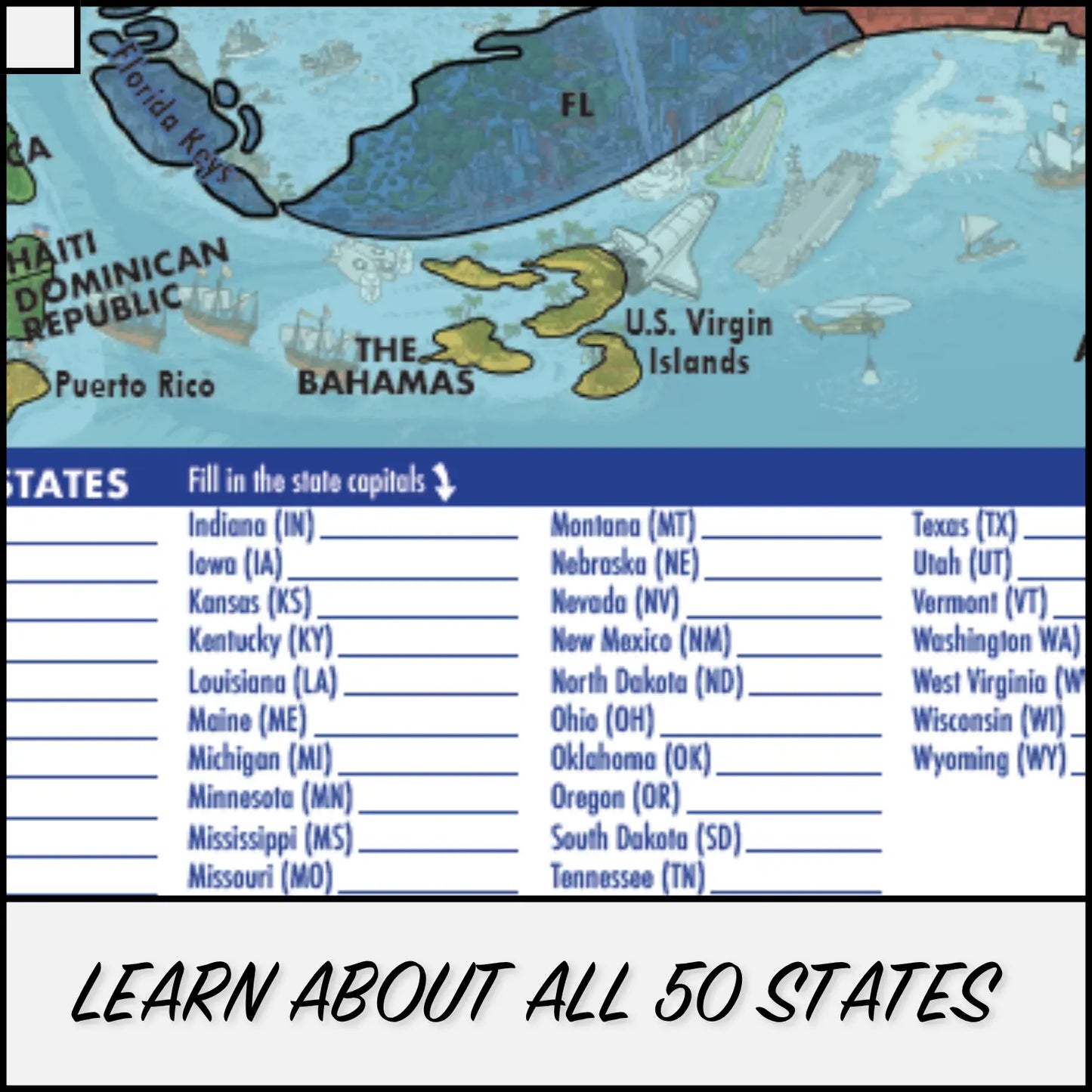
See the entire poster mapped out in one foldout guide. Every state labeled, the original 13 colonies highlighted, plus U.S. territories, Canadian provinces, and all of America's neighbors. Get your bearings in seconds — then start exploring.
See the entire poster mapped out in one foldout guide. Every state labeled, the original 13 colonies highlighted, plus U.S. territories, Canadian provinces, and all of America's neighbors. Get your bearings in seconds — then start exploring.

The Map Is Just The Beginning
The map is just the beginning. Quiz yourself on all 50 state capitals with the fill-in challenge, hunt down hidden details with the seek-and-find, and test your memory with 13 questions — no peeking at the answers on the back! It's geography, history, and game night rolled into one foldout.
The map is just the beginning. Quiz yourself on all 50 state capitals with the fill-in challenge, hunt down hidden details with the seek-and-find, and test your memory with 13 questions — no peeking at the answers on the back! It's geography, history, and game night rolled into one foldout.